Drone Photography: Elevating Your Listings
Aerial photography has revolutionized real estate marketing. What was once prohibitively expensive helicopter photography is now accessible and affordable through drone technology. But drone photography isn't just about showing off—it's about providing perspectives that help buyers understand a property's full context and value.
Why Drone Photography Matters
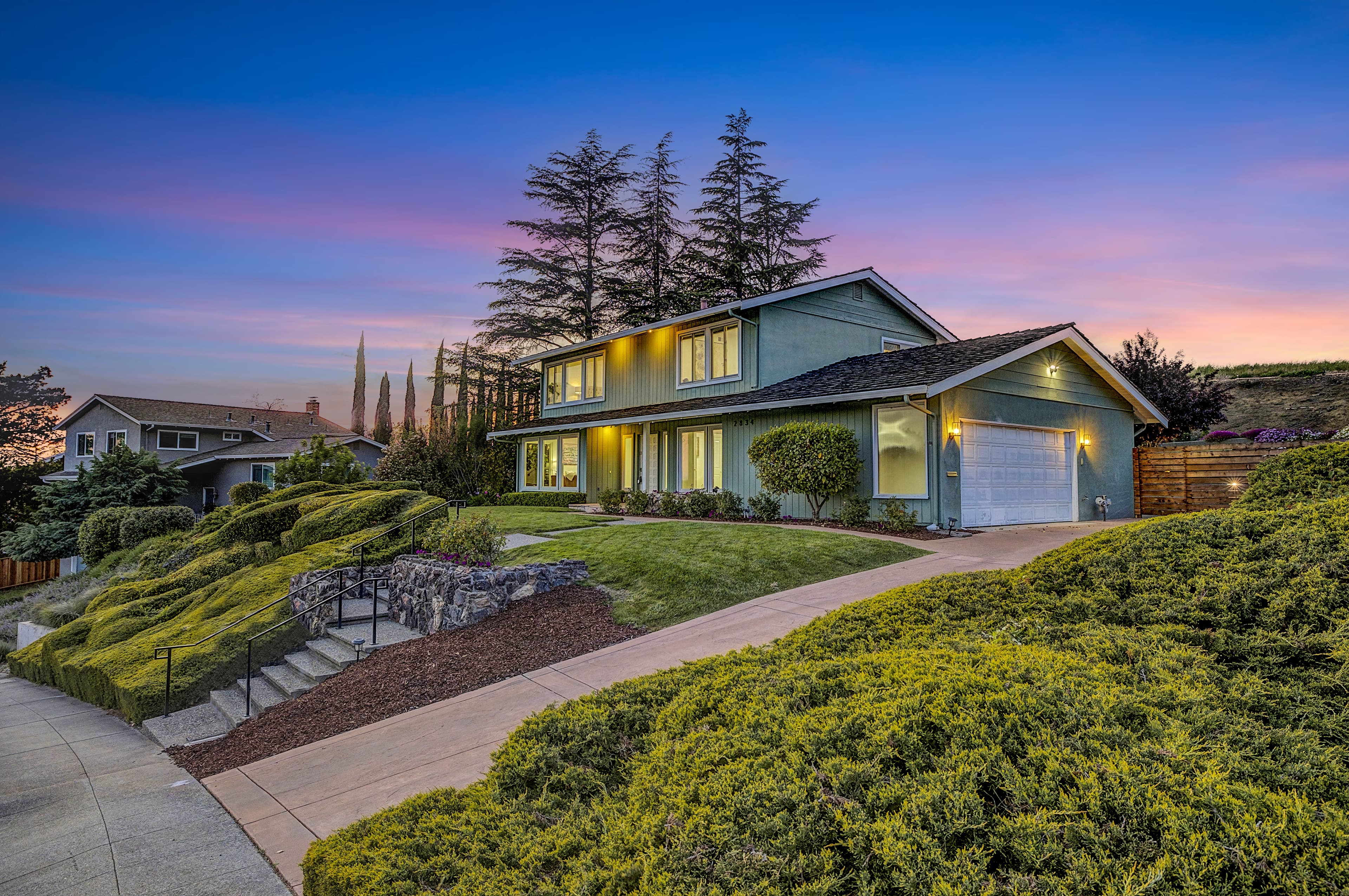
Ground-level photos can only tell part of a property's story. Drone shots reveal lot size, property boundaries, neighborhood context, and surrounding amenities in ways traditional photography cannot. For buyers viewing listings online, aerial perspectives provide crucial information about the property's setting, privacy, views, and relationship to nearby features like parks, water, or commercial areas.
What Drone Photography Reveals
Aerial shots excel at showcasing property features that ground-level photos miss. Large lots appear truly spacious from above. Proximity to amenities like golf courses, beaches, or downtown areas becomes immediately clear. Outdoor spaces—pools, gardens, patios, sports courts—gain proper context. Views that make a property special are captured in their full glory. Even parking arrangements and driveway access are better understood from an aerial perspective.
Legal Requirements and Regulations
Professional drone photography requires FAA Part 107 certification. Licensed pilots understand airspace restrictions, no-fly zones around airports, and altitude limitations. They carry proper liability insurance protecting property owners and clients. Attempting DIY drone photography without proper licensing risks legal consequences and insurance complications. Always work with certified, insured drone operators.
Best Conditions for Drone Photography
Weather dramatically impacts drone photography quality. Calm conditions are essential—high winds create unstable footage and limit safe flying. Clear or partly cloudy days produce the best imagery. Overcast skies flatten images and should be avoided. Morning or late afternoon provides the most attractive lighting, though midday works for showcasing pool water color. Seasonal considerations matter too; summer greenery looks more appealing than winter dormancy in most markets.
Planning Your Drone Shoot
Effective drone photography requires advance planning. Schedule shoots for optimal weather and lighting conditions. Prepare the property's exterior—mow lawns, trim hedges, remove clutter from yards and driveways. Ensure pools are clean and covers are removed. Move vehicles that might clutter aerial views. Check with neighbors about any potential concerns or advance notice requirements. Coordinate timing to avoid neighborhood activities that might appear in shots.
Types of Aerial Shots
A comprehensive drone package includes multiple shot types. High-altitude overviews show the entire property and surrounding area. Mid-range shots capture the home's architecture and immediate grounds. Low-altitude detail shots highlight specific features like pools or outdoor living areas. Orbital shots circle the property for dynamic perspectives. Straight-down shots effectively display lot layout and landscaping. Each angle serves a specific purpose in telling the property's complete story.
Video vs. Still Images
Both aerial video and still images have their place. Still photos work best for MLS listings, brochures, and print materials. They allow buyers to study specific views at their own pace. Aerial video creates cinematic property tours perfect for social media, websites, and YouTube. Video provides a sense of movement and scale that stills cannot match. Most comprehensive marketing packages include both mediums.
Luxury Listings Demand Aerial Coverage
For high-end properties, drone photography isn't optional—it's expected. Luxury buyers anticipate comprehensive visual documentation including aerial perspectives. Properties with premium features like ocean views, mountain vistas, large estates, vineyards, or significant acreage require aerial coverage to properly represent their value. Listings without drone imagery appear incomplete in the luxury market.
Pricing and Value
Drone photography pricing varies based on property size, shot complexity, and package scope. Basic aerial packages start around $150-250, while comprehensive packages with video can run $500-1000+. While more expensive than standard photography, the investment generates significant returns. Properties with aerial imagery receive more views, longer page engagement, and higher perceived value. The cost is minimal compared to the potential sale price increase and reduced market time.
Common Mistakes to Avoid
Several common errors undermine drone photography effectiveness. Flying too high makes properties appear small and insignificant. Shooting on windy days results in shaky, unprofessional footage. Neglecting to prepare the property's exterior—unmowed lawns, cluttered driveways—wastes the opportunity. Scheduling shoots during poor weather conditions produces flat, unappealing imagery. Using unlicensed operators risks legal issues and compromised quality. Failing to coordinate with neighbors can create complaints and complications.
Conclusion
Drone photography has evolved from luxury option to essential marketing tool. The aerial perspective provides context and understanding that ground-level photography cannot deliver. For buyers making decisions based primarily on online listings, comprehensive aerial coverage can mean the difference between scrolling past and scheduling a showing. Invest in professional, licensed drone photography to give your listings the elevated presentation they deserve—literally and figuratively.